
Platforms
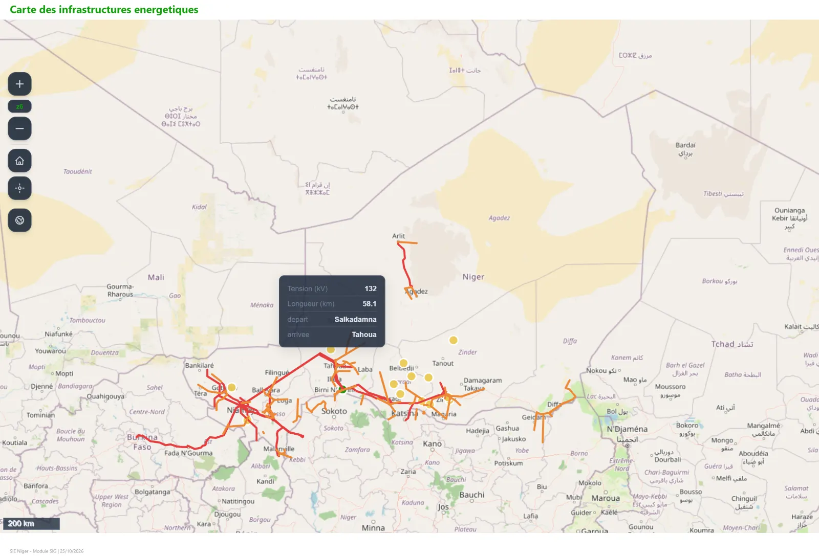
Energy infrastructure GIS
A geographic information system dedicated to energy infrastructure, connected to your statistics.
What we deliver
- Georeferenced database of power plants, transmission and distribution networks, and fuel facilities
- Interactive web maps with filters by type, capacity and status
- Links between each asset and its production or capacity statistics
- Exports for planning studies and reports
Contact
Let’s talk about your project
Tell us about your needs and we will get back to you quickly.
Contact us